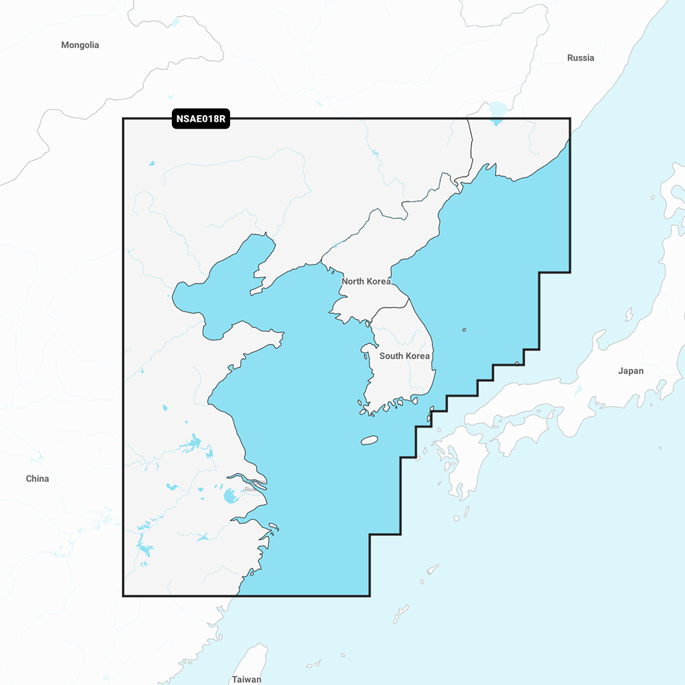
Garmin Navionics+ NSAE018R - Yellow Sea - Marine Chart
Best navigation tool for mariners exploring the Yellow Sea.

Navigate the Yellow Sea with the Garmin Navionics+ NSAE018R Marine Chart. This essential cartography brings the world's leading Navionics+ data to your compatible chartplotter, featuring a vibrant interface and integrated Garmin and Navionics content. Enjoy daily chart updates for a year via ActiveCaptain, Auto Guidance+ Technology for suggested routes, and high-resolution depth shading for pinpointing fishing areas. Coverage includes the East Asian coast, supplied on a convenient MicroSD/SD Card for easy installation and use.
$120.36
Owner Satisfaction
4.7
/ 5
Category Rank
4
/ 330
#4 in Marine Electronics
Price vs Category Average
-85%
Below average
Format
MicroSD/SD Card
/ MicroSD/SD Card
Who it's for
- Anglers and navigators needing precise depth data for coastal safety
- Mariners requiring the latest hazard data for safe passage
- Captains seeking automated routing and real-time custom mapping tools
Who should skip it
- Owners preferring one-time purchases over ongoing annual subscription fees
- Budget-conscious boaters looking for affordable regional navigation solutions
- Voyagers planning long-distance trips across multiple international maritime regions
Performance breakdown
Navigation Precision
Auto Guidance+ technology delivers highly reliable route suggestions for complex coastal waters.
Data Freshness
Daily chart updates via ActiveCaptain ensure your navigation data remains current.
Bathymetric Detail
One-foot contours provide exceptional clarity for identifying underwater structure and fishing spots.
Interface Integration
The streamlined Navionics style interface feels intuitive on compatible Garmin chartplotters.
Installation Ease
Plug-and-play MicroSD card format makes setup effortless for any marine user.
Community Connectivity
ActiveCaptain integration offers valuable crowdsourced insights from fellow mariners nearby.
Key Specs
Format
MicroSD/SD Card
Weight
0.1 lb
Brand
Garmin
Model Number
GAR-010-C1216-20
Certifications
NMEA Certified, ABYC Certified
Chart Coverage
Yellow Sea area
Firmware Updatable
Yes
Network Compatibility
ActiveCaptain
Features
- All-in-one map solution
- Daily chart updates included
- Auto Guidance+ Technology
- Customizable depth range shading
- Detailed 1' contours
- Shallow water shading
- ActiveCaptain Community content
- Streamlined Navionics style interface
What customers say
Customers overwhelmingly praise the Garmin Navionics+ chart for its exceptional accuracy and comprehensive coverage of the Yellow Sea. The high resolution bathymetric data is a major benefit, offering precise depth contours crucial for navigating complex or shallow areas safely. Users find integration with existing Garmin displays seamless and intuitive, enabling immediate use of advanced features. Key navigational aids, like enhanced Auto Guidance and customizable shading, significantly boost operational efficiency. While the initial cost is premium, the unparalleled confidence and detailed information provided justify the investment for serious boaters. The core chart data quality is universally lauded, making this an essential tool for reliable maritime navigation in this region.
Know before you buy
The Garmin Navionics+ NSAE018R is supplied on a pre-programmed MicroSD card with an SD card adapter, making it ready for immediate use in your compatible chartplotter.
You can access daily updates by syncing your chartplotter with the ActiveCaptain app on your smartphone. This allows you to download the latest cartography data directly to your card for one year.
Auto Guidance+ combines the best features of Garmin and Navionics automatic routing to suggest a path to your destination. It calculates a suggested route based on your boat's specific draft and overhead clearance settings.
Yes, the chart features customizable depth range shading. You can highlight specific depth ranges to easily identify drop-offs, ledges, and other structures where fish tend to congregate.
Compatibility depends on your specific model. While this card works with most modern Garmin chartplotters, we recommend checking the Garmin website's compatibility tool using your device's model number to ensure full feature support.
This chart provides highly detailed 1-foot contours. This level of precision offers a clearer picture of bottom structure, which is essential for safer navigation in shallow areas and more accurate fishing.

Still have a question?
Ask Hayley anything about this product before you decide.
Ready to buy?
$120