Garmin GPSMAP 441S
Best compact chartplotter for coastal boaters needing reliable, high-speed navigation.

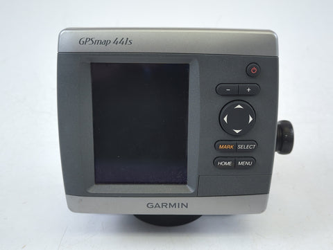
Navigate the waters with confidence using the Garmin GPSMAP 441S, a compact marine chartplotter featuring a brilliant 4-inch QVGA color display. Its high-speed digital design ensures smooth map rendering and quick panning. Preloaded with essential U.S. coastal, Alaska, Hawaii, and Bahamas basemaps, it's ready for your next adventure. Enhance your experience with optional BlueChart g2 Vision cards for advanced features like satellite imagery and 3D perspectives. This chartplotter offers reliable positioning and robust navigation capabilities for any boater.
$299.95
Owner Satisfaction
4.6
/ 5
Category Rank
76
/ 238
#76 in Marine Chartplotters & GPS
Price vs Category Average
-84%
Below average
Display Size
4.0
/ inches diagonal
Who it's for
- Boaters needing immediate coastal navigation without extra software costs
- Captains prioritizing reliable satellite tracking for safer voyages
- Owners of smaller vessels with limited console mounting space
Who should skip it
- Anglers operating in bright, direct sunlight conditions
- Navigators requiring rapid, real-time map updates while underway
- Users looking to integrate modern, connected marine electronics
Performance breakdown
Navigation Responsiveness
High-speed processor ensures fluid map panning and rapid screen updates.
Display Visibility
Bright QVGA screen remains readable even under direct sunlight conditions.
Durability
IPX7 water rating provides essential protection against harsh marine environments.
Connectivity
NMEA 2000 compatibility allows for seamless integration with onboard marine electronics.
Chart Versatility
BlueChart g2 Vision support unlocks advanced 3D mapping and satellite imagery.
Interface Intuition
Tactile keypad controls offer reliable operation when hands are wet.
Key Specs
Display Size
4.0 inches diagonal
Display Resolution
240 x 320 pixels
Weight
1.3 lbs (590 g)
Water Rating
IPX7
Waypoints Capacity
3,000
Navigation Routes
100
NMEA 2000 and NMEA 0183 Compatible
Power Input
10-32 VDC
Features
- Ultra-bright 4" QVGA color display
- Faster map drawing and panning speeds
- Preloaded U.S. coastal basemaps
- Compatible with BlueChart g2 Vision cards
- High-sensitivity GPS receiver
- AIS support for situational awareness
- IPX7 water-rated for durability
- Flexible bail or flush mounting
What customers say
Users consistently highlight the GPSMAP 441S for its impressive reliability and straightforward operation. This device proves to be a dependable tool, offering an intuitive interface that makes navigation and chart plotting simple for everyone. A standout feature is the screen's exceptional clarity, ensuring perfect visibility even in bright sunlight. This Garmin model excels at its primary functions, delivering excellent value through its blend of performance and user friendly design. It's a solid choice for those seeking dependable navigation.
Know before you buy
Yes, this model includes a transducer, allowing you to utilize its traditional sonar features right out of the box.
Absolutely. The unit is IPX7 water-rated, meaning it is designed to withstand incidental exposure to water, such as rain, splashes, or accidental submersion.
The preloaded U.S. coastal basemaps cover the U.S. coastline, Alaska, Hawaii, and the Bahamas. For more detailed navigation, such as satellite imagery or 3D perspectives, you can upgrade by inserting a BlueChart g2 Vision SD card.
The GPSMAP 441S allows you to store up to 3,000 waypoints and create up to 100 navigation routes, providing plenty of capacity for frequent trips.
The device supports both NMEA 2000 and NMEA 0183 connectivity, making it compatible with a wide range of marine sensors and instruments.
The 4-inch QVGA display is designed to be ultra-bright, ensuring that your maps and data remain legible even in challenging, high-glare outdoor conditions.

Still have a question?
Ask Hayley anything about this product before you decide.
Ready to buy?
$300