Garmin GPSMAP 8410 10 Chartplotter
Best high-performance navigation display for serious sailors and powerboat cruisers.

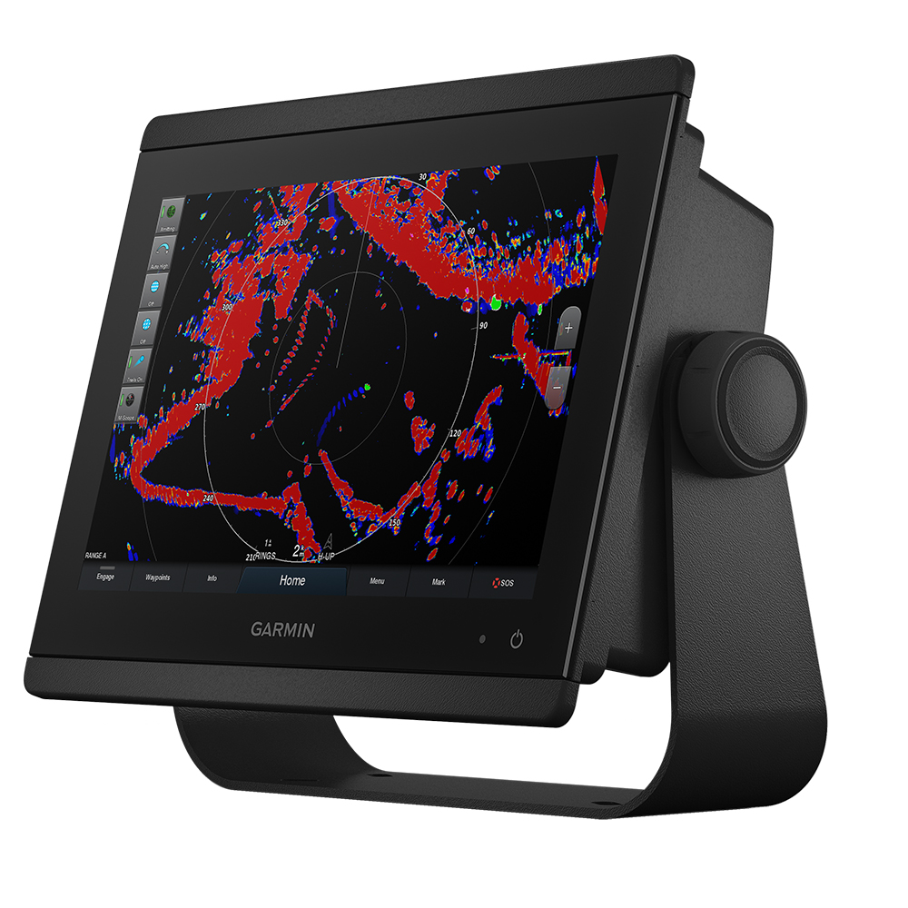
The Garmin GPSMAP 8410 is a 10-inch chartplotter designed for serious cruisers, sailors, and racers. It features a full HD IPS touchscreen display for excellent clarity and sunlight readability, even with polarized sunglasses. Fully network capable, it integrates seamlessly with other marine electronics like radar and autopilots via NMEA 2000 and the Garmin Marine Network. Built-in Wi-Fi and Bluetooth connectivity enhance its versatility, allowing for app control and data sharing. The GPSMAP 8410 supports advanced features like Auto Guidance and offers expandable memory for detailed charts.
$2329.59
Owner Satisfaction
4.5
/ 5
Category Rank
146
/ 338
#146 in Marine Chartplotters & GPS
Price vs Category Average
+22%
Above average
Screen Size
10
/ inches
Who it's for
- Captains navigating in direct, harsh sunlight
- Skippers managing complex, multi-device marine networks
- Serious sailors needing comprehensive, integrated navigation tools
Who should skip it
- Budget-conscious boaters seeking entry-level navigation gear
- Users wanting an all-inclusive, out-of-the-box solution
- Casual mariners preferring simple, plug-and-play interfaces
Performance breakdown
Display Clarity
Full HD IPS screen remains perfectly readable even under direct sunlight.
System Integration
Seamlessly unifies radar, autopilot, and third-party gear into one interface.
Processing Speed
High-performance processor ensures rapid map rendering and fluid menu navigation.
Sailing Utility
SailAssist provides essential tactical data for competitive racers and cruisers.
Connectivity Versatility
Wi-Fi and Bluetooth integration simplify data sharing and mobile app control.
Network Expandability
Robust NMEA 2000 and Garmin Marine Network ports support complex setups.
Key Specs
Screen Size
10 inches
Weight
11.6 lb
Antenna Type
Internal
Cartography Brand
Garmin
NMEA 2000 Ports
1
NMEA 0183 Input Ports
1 Differential
NMEA 0183 Output Ports
1 Differential
Garmin Marine Network Ports
2
Features
- Full HD IPS touchscreen display for wider viewing angles and superior clarity.
- Fully network capable with NMEA 2000 and Garmin Marine Network.
- Includes Bluetooth, ANT technology, and Wi-Fi networking.
- Garmin SailAssist provides critical sailing data and prerace guidance.
- SmartMode station controls for quick, one-touch access to information.
- OneHelm system coordinates third-party marine products for integrated control.
- Premium-performance processor for fast map drawing and superior networking.
- Compatible with ActiveCaptain app for trip planning, software updates, and map purchases.
What customers say
Customers consistently praise the Garmin GPSMAP 8410 for its exceptional display quality and robust build, making it a reliable companion on the water. The vibrant, high resolution screen is frequently highlighted for its clarity, even in bright sunlight, enhancing navigation and situational awareness. Users appreciate the intuitive interface, finding it straightforward to operate despite the advanced feature set. This combination of premium construction and user friendly design contributes to a highly positive experience, reinforcing its reputation as a top tier marine chartplotter.
Know before you buy
Yes. The unit features a full HD IPS display specifically designed for superior clarity and sunlight readability, ensuring the screen remains visible even when you are wearing polarized eyewear.
Yes, the OneHelm system allows you to coordinate and control compatible third-party marine products directly from the chartplotter interface, creating a centralized command station.
Absolutely. The integrated Garmin SailAssist feature provides critical sailing data, such as laylines, race start guidance, and wind information, to help you gain a competitive edge.
SmartMode station controls allow you to program and access specific screen layouts with a single touch. This lets you quickly switch between different operational modes, such as docking, cruising, or fishing, without manually adjusting individual displays.
Yes. By connecting the GPSMAP 8410 to the ActiveCaptain app via built-in Wi-Fi, you can easily download software updates, plan trips, and purchase new map data directly from your mobile device.
The two Garmin Marine Network ports allow you to share data, such as sonar, radar, and camera feeds, across multiple compatible Garmin displays on your vessel, ensuring all your electronics work as a single, cohesive system.

Still have a question?
Ask Hayley anything about this product before you decide.